Mastodon Peak trail in Joshua Tree National Park—featuring rugged rock formations, panoramic views, desert flora, and the trail’s expansive vistas.
Mastodon Peak Trail Highlights
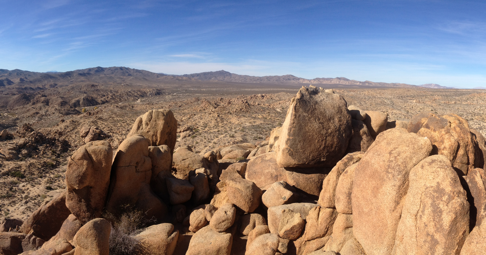
Trail Overview & Panorama Views
This moderately challenging ~3-mile loop starts at the Cottonwood Spring Oasis parking lot, weaving through a unique fan palm oasis, arid scrubland, and ending with an optional scramble up Mastodon Peak. You’re rewarded with sweeping 360° views, including the Salton Sea to the south, Eagle Mountain to the east, and the surrounding desert expanse.National Park ServiceHikespeakBackpacker
Trail Stats & Terrain
- Distance: 2.4–2.6 miles (loop)National Park ServiceHikespeakjoshuatreehikingtrails.comoutdoorblueprint.com
- Elevation Gain: Around 375–440 feetNational Park ServiceHikespeakjoshuatreehikingtrails.comoutdoorblueprint.com
- Terrain: Mix of dirt, sand, rock; includes desert scrub, boulder fields, and loose washesNational Park Servicethesimplehiker.comoutdoorblueprint.comHikespeak
Trail Features & Highlights
- Cottonwood Spring Oasis: A lush start with California fan palms and cottonwood trees—an oasis in the Colorado Desertoutdoorblueprint.comSummitPostNational Park Service
- Mastodon Peak Summit: A short but steep scramble with loose, rocky terrain (Class 2–3). Climbers come here for that panoramic sceneryoutdoorblueprint.comHikespeakSummitPost
- Mastodon Mine and Winona Mill Ruins: Historic remnants of early 20th-century gold mining along the return loop—significant slices of Joshua Tree historyHikespeakBackpackerSummitPost
Safety & Conditions
- Shade & Service: The trail is almost entirely exposed—bring sun protection and start early to avoid heat. There’s no cell serviceNational Park Serviceoutdoorblueprint.com
- Desert Hike Realities: Desert sand, loose trail sections, and navigation challenges can make an otherwise short hike feel tougher. Trail complexity and scrub terrain contribute to the moderate ratingReddit
- No Pets Allowed: Only leashed service animals are permitted, but pets are otherwise prohibitedNational Park ServiceHikespeak

Quick Comparison Table
| Feature | Details |
|---|---|
| Trail Type | Loop (with optional scramble) |
| Distance | Approx. 2.4–2.6 miles |
| Elevation Gain | 375–440 ft |
| Main Highlights | Palm oasis, boulder scramble, views, historical mine ruins |
| Difficulty Level | Moderate (main trail); scramble adds challenge |
| Best Visit Times | Winter, spring, and fall (cooler temperatures) |
| Warnings | No shade, no cell service, crowded parking possible |
Visitor Voices
Eager hikers on Reddit report:
“Mastodon Peak is actually pretty easy. The only hard part is navigating to the top via rock scrambling.”Reddit
Another noted:
“…pretty easy hike to get here and if you go up Mastodon Peak there’s a great view of the area.”Reddit
These experiences highlight that while the trail is generally accessible, the scramble and trail complexity can increase the challenge.
Trail Planning Tips
- Best Seasons: Aim for fall, winter, or spring. Summer heat can be intense, especially with no shade.outdoorblueprint.com
- Timing Matters: Start before 9 a.m. to offset heat and ensure quieter trails.National Park Service
- Gear Up: Bring plenty of water, sun protection, and perhaps trail maps or GPS—since cell service is absentNational Park Serviceoutdoorblueprint.comReddit
- Navigation: Favor counterclockwise direction for easier trailflow and a stronger finishHikespeakhikingguy.com
In Summary
The Mastodon Peak Loop is a rewarding and lesser-traveled Joshua Tree hike offering oasis views, desert panoramas, hiking history, and a fun rock scramble. Ideal for hikers seeking something away from the crowds near Park Boulevard—but still packed with natural beauty and old-world character.
Would you like directions, a GPX file, or ideas for pairing this hike with others nearby? Let me know and I’ll pull that together!
Tags: joshua tree hikes, joshua tree national park hikes, joshua tree national park trails, joshua tree trails, mastodon peak, mastodon peak trail