The Lost Horse Mine is one of Joshua Tree National Park’s most fascinating historic sites — a perfect blend of Old West history and desert beauty on an out and back 4 mile trail.
⛏️ Lost Horse Mine – Overview
- Location: In the western part of Joshua Tree National Park, near Keys View Road.
- Type: A preserved gold mine from the late 1800s–early 1900s.
- Trail Length: About 4 miles round trip (moderate).
- Elevation Gain: ~550 feet.
🏜️ History
- Discovered in the 1890s, it became one of the most successful gold mines in the area.
- Produced over 10,000 ounces of gold and 16,000 ounces of silver (today worth over $5 million).
- Mining operations continued until the 1930s, after which the site was abandoned.
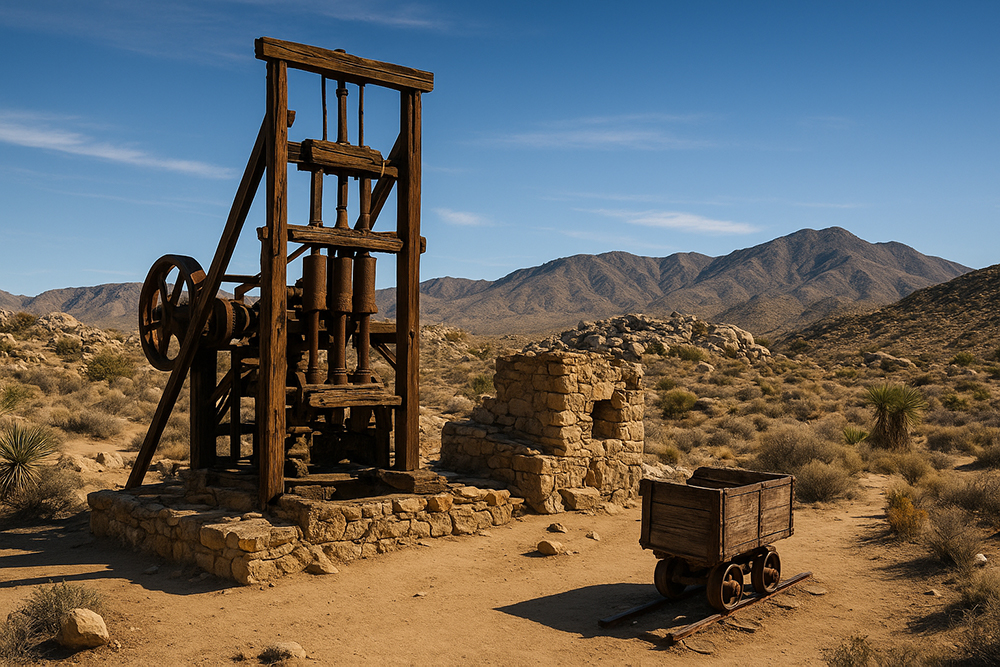
- The 10-stamp mill, remarkably well-preserved, still stands as one of the best examples of early mining technology in California deserts.
🚶 The Hike
- Starts at Lost Horse Mine Trailhead off Keys View Road.
- Out-and-back: 4 miles (moderate).
- Option for a 6.5-mile loop that includes sweeping desert views and more solitude.
- Along the way: Joshua trees, yucca, desert scrub, and wide panoramas.
🌟 Highlights
- The stamp mill ruins, fenced off but clearly visible — a centerpiece of park history.
- Scenic desert views toward San Gorgonio Mountain and Coachella Valley.
- A sense of stepping back in time to the California Gold Rush days.
⚠️ Tips
- No shade along the trail — bring plenty of water and go early in the day.
- Stay on the trail (open mine shafts in the area can be dangerous).
- Spring is the best time to hike (mild temps, wildflowers).
Final Thoughts:
Lost Horse mine trail captures the ruins with the desert mountains in the background — kind of like a historic-meets-wild-west vibe, is definitely a must see.
Tags: Joshua tree, joshua tree hikes, Joshua Tree national park, joshua tree national park hikes, joshua tree national park trails, joshua tree trails, lost horse mine